Tuesday, December 10, 2013
Monday, November 18, 2013

Thursday, November 14, 2013
Typhoon Haiyan

Satellite imagery of Tacloban coast before and after the typhoon in the Phillipines.
Link: http://www.telegraph.co.uk/news/worldnews/asia/philippines/10446056/Typhoon-Haiyan-Satellite-imagery-shows-before-and-after-devastation.html
Tuesday, November 12, 2013

Friday, November 8, 2013

Wednesday, November 6, 2013
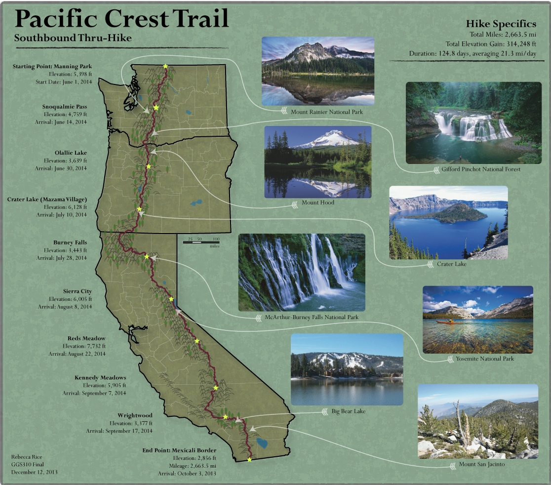
Final Project Proposal: PCT Map
For my final project I am going to create a map of the Pacific Crest Trail (PCT), including a route for a thru-hike that includes resupply points and potential scenic stops along the way. The PCT is a 2,663 mile trail that extends from the California/Mexico Border all the way through the Sierra Nevada to British Columbia, Canada. I would like to map the PCT because I think it would render the possibility of a very unique map. I first became interested in the PCT after reading Wild, a memoir by Cheryl Strayed of her thru-hike of the PCT. A few years ago, one of my good friends hiked the Appalachian Trail, and he's been encouraging me to try it once I graduate. I feel like hiking the PCT would be more of an accomplishment since it's longer (the AT is 22,00 mi), more scenic, and something that no one else I know has done. Creating this map will help me improve my knowledge of the PCT and may be more of a motivator for me to actually do it someday!


The map will include California, Oregon, Washington, and part of BC, Canada. I am going to obtain my data from the official PCT Association website (http://www.pcta.org/discover-the-trail/long-distance-hiking/). I'm also going to look at thru-hike blogs for more information on cool stopping points along the trail. I plan on obtaining a shapefile from the ESRI online database to include the 3 states and part of Canada I will include.
Wednesday, October 30, 2013
Dot Density Map

Flickr and Twitter Posts in Europe. Red dot indicates location of Flickr post, Twitter is blue, and white indicates both.
Source: Flickr
Subscribe to:
Comments (Atom)